
Newton ZIP Code Directory Coverage
Newton’s official geography material identifies ten ZIPs serving the city. Their labels track postal areas, not civic districts. The post-office column below uses the published postal designation rather than asserting a station assignment, because one official Newton page did not expose a complete station-to-ZIP list. Verify a particular address with USPS before relying on a postal label.
| ZIP | Areas Covered | Post Office | Notes |
|---|---|---|---|
| 02458 | Newton and central Newton labels | Newton postal designation | Postal area, not a ward. |
| 02459 | Newton Centre | Newton Centre postal designation | Does not equal every village boundary. |
| 02460 | Newtonville | Newtonville postal designation | Compare with Newton GIS and city village layers. |
| 02461 | Newton Highlands | Newton Highlands postal designation | A Newton area-council boundary is not the ZIP boundary. |
| 02462 | Newton Lower Falls | Newton Lower Falls postal designation | Verify a Newton exact address with USPS. |
| 02464 | Newton Upper Falls | Newton Upper Falls postal designation | Newton village and ZIP remain separate labels. |
| 02465 | West Newton | West Newton postal designation | Compare to the city boundary. |
| 02466 | Auburndale | Auburndale postal designation | Newton postal polygon and village association differ. |
| 02467 | Chestnut Hill | Chestnut Hill postal designation | Crosses Newton, Brookline, and Boston. |
| 02468 | Waban | Waban postal designation | Does not establish a Newton neighborhood-council boundary. |
The city table does not list 02456 as a standard Newton ZIP, although a New Town sorting designation appears in some USPS material. Treat that label as address-specific and validate it rather than adding it to the city’s complete postal list.
Verify a Newton ZIP Code
The USPS ZIP Lookup is the official address-to-ZIP and ZIP-to-address verification route. Its application is dynamically rendered, so the inspected source did not expose a stable form-field inventory. Use the full street address when possible. A city-facing postal label is useful for mail routing, but it cannot determine the government office that keeps a parcel, court, permit, or City Clerk record.
- Write down the complete modern street address, including the number, street spelling, and any suffix.
- Validate it through USPS and retain the returned postal city and ZIP.
- Check the Newton GIS ZIP layer and village designation for geographic context.
- Confirm the actual municipality with a parcel or city-boundary layer before requesting records.
- Use the Newton, Brookline, or Boston custodian that matches the parcel’s municipality, not just the postal label.
For a postal question that cannot be resolved online, use the USPS station for address-specific help. Newton GIS and Assessing can discuss a parcel at 617-796-1160, while a local clerk can help identify the municipal record channel. Those are different questions, and they may yield different answers for the same mailing address.
Note: A ZIP result validates postal routing, while a parcel or city-boundary result identifies governmental jurisdiction.
Map Newton ZIP Code Areas
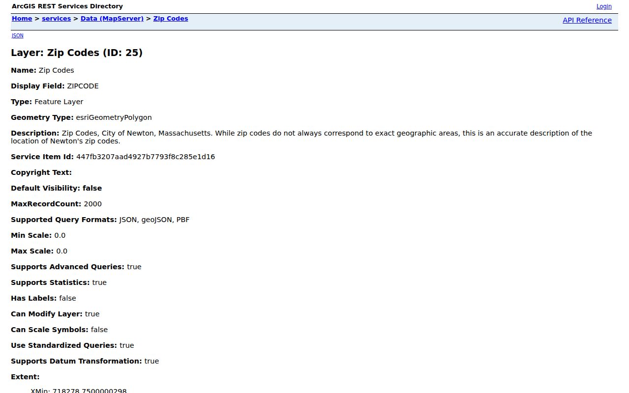
Newton GIS publishes a dedicated ZIP layer with two recorded fields: ZIPCODE, labeled ZIP Code, and Village_PO, labeled Postal Village Designation. The layer is a helpful visual bridge between an address and its postal context. It is not a legal boundary source. The data dictionary warns that USPS does not treat ZIP codes as exact geographic areas, and ZIPs may overlap or be non-contiguous even when the map renders them as polygons.
The Newton GIS ZIP layer shows the ZIPCODE and Village_PO fields used for local postal mapping.
Pair the postal layer with property boundaries, addresses, streets, wards and precincts, zoning, and historic layers in the Newton GIS Browser when the geographic question affects a records request.
Since 1992, Newton GIS has grown into one of the older municipal GIS programs in New England and includes about 80 layers. That range is useful for comparing records geography without confusing one layer for another.
Search Newton Residents by ZIP Code
A ZIP can narrow where to look, but the local portals do not create a ZIP-wide resident list. MapGeo’s inspected quick-search fields are Address, Co-owner Name, Owner, and SBL. Newton tax self-service accepts address, owner, parcel, bill, and tax-year paths. Both work by parcel or name rather than a ZIP filter. GIS can show the ZIP polygon and its relation to parcels, while the statewide voter lookup uses a residential ZIP only to verify one individual.
- Validate the address and identify the postal ZIP with USPS.
- Open the GIS ZIP layer and locate the address in relation to the polygon and city boundary.
- Search MapGeo or tax self-service by the address or SBL to identify the parcel record.
- Use the Massachusetts voter tool only for an individual’s registration status with the required name, date of birth, and ZIP.
- Move to the municipal custodian that controls the parcel or record type, especially near a boundary.
When the ZIP has narrowed the address to a particular Newton street, use the Newton Street Directory for the parcel, deed, permit, and historic address workflow. The street-level records are more precise than a postal area.
Newton ZIP Code Portal Limits
Each portal treats ZIP information differently. The table keeps the field and access limits visible before a search begins. In particular, the voter tool’s residential ZIP field is an individual verification requirement, not a route to a ZIP-wide result. Likewise, a GIS polygon is a map context layer, not evidence that every parcel or person inside it belongs to the same municipal record system.
| Portal | ZIP Field or Mode | What It Returns | Limit |
|---|---|---|---|
| Newton MapGeo | Address, co-owner, owner, SBL; no ZIP field inspected | Parcel, address, owner and property fields | No demonstrated ZIP-wide quick search |
| Newton GIS Browser | ZIP Codes layer and map browse | ZIP polygon and parcel relationship | Map context, not a resident list |
| Newton parcel REST | Separate ZIP layer, spatial intersection possible | ZIP polygon fields and parcel query context | ZIP is not an exact city area |
| Tax self-service | Address, owner, parcel, bill, tax year | Tax and parcel search | No ZIP field observed |
| Voter Registration Search | Residential ZIP required for an individual | Individual registration and polling status | No ZIP-wide voter result |
| USPS ZIP Lookup | Address or ZIP validation application | Postal ZIP and city-state relationship | Not a civic-boundary tool |
| MassGIS ZIP polygons | State ZIP dataset | Postal polygon context | USPS geography caveat applies |
The Massachusetts Voter Registration Search also requires first name, last name, date of birth, a five-digit residential ZIP, and an acknowledgement. It can return status, polling location, and official assignments, but it does not supply a street roster or ZIP directory of voters.
02467 Across Newton and Beyond
Chestnut Hill gives the clearest local example of why a postal area should not decide jurisdiction. Newton’s official geography material says 02467 includes a large part of Brookline and a small part of Boston as well as Newton. An address carrying the Chestnut Hill postal designation can therefore belong to a different municipality and a different set of local offices. Check the parcel and city boundary before choosing an assessor, clerk, permit office, court, or public-record request route.
This is a practical geography issue for people tracing a family address, comparing an old map, or confirming which records custodian holds a document. The municipality follows the parcel location. The ZIP merely helps route mail. A Newton-facing search can miss the proper office if it stops at the postal city.
Newton ZIP Boundaries and City Limits
ZIP boundaries, villages, wards, precincts, counties, and school districts are separate systems. Newton has thirteen named villages but ten postal ZIPs, and no ZIP should be treated as a substitute for the others. The city has eight wards with four precincts each. Those election districts are created for local administration, while the ZIP layer represents postal geography. Use an address and the relevant official layer for the question at hand.
- ZIP Code
- A postal routing label that can cover more than one municipal area or have an irregular shape.
- ZIP+4
- An added four-digit delivery segment used by USPS to refine mail routing within a ZIP Code.
- PO-box ZIP
- A ZIP designation used for post-office boxes rather than a broad physical delivery area.
- Unique ZIP
- A ZIP assigned to a single organization or delivery destination, when USPS uses one.
- Carrier route
- A USPS delivery sequence within a postal area, not a city boundary or public resident list.
Newton’s GIS ZIP polygons are useful for explanation and visual orientation. They do not make a postal boundary legally exact, and the GIS notice says no decision should rest on that layer alone.
Newton Villages and Postal Areas
Auburndale, Chestnut Hill, Newton Centre, Newton Corner, Newton Highlands, Newton Lower Falls, Newton Upper Falls, Newtonville, Nonantum, Oak Hill, Thompsonville, Waban, and West Newton give Newton its local vocabulary. Not all of those village names have their own ZIP. A historical directory may use a village name, while a modern postal result uses a different label. Newton Centre and Newton Center are another search variant worth preserving.
For family history, former classmates, or an older address, start with the street, village, atlas, and parcel rather than forcing a historical record into a modern ZIP. The Newton Free Library’s local-history collections include directories, resident lists, newspapers, maps, obituary material, yearbooks, and microfilm that use the terms of their own period.
Note: Keep village and postal names beside the address when comparing a current GIS result with a printed Newton source.
Newton ZIP History Before 1963
ZIP codes began nationally in 1963. Newton-specific split or realignment dates were not located in official sources, so no local realignment date should be assumed. A 1901 directory cannot be searched by a modern ZIP. Translate the older address with its street, house number, village, atlas or Sanborn sheet, and parcel or legal-description clues instead.
Newton’s printed directory history begins in 1868, with Polk directories generally every second year through 1934 and a 1936 through 1985 run. The house section, resident lists, maps, and newspaper microfilm make it possible to follow an address across time, but a missing volume may be a publication gap. Postal terminology is only one part of that record trail.
Newton ZIP Research Channels
Online research begins with USPS ZIP Lookup, the Newton GIS ZIP layer, MapGeo, tax self-service, and the city’s geography material. For an address-specific postal issue, contact a USPS station. For a Newton parcel question, call GIS or Assessing at 617-796-1160. A city clerk can help with municipal jurisdiction, while the record itself may belong with the Assessor, City Clerk, Middlesex South Registry of Deeds, or a neighboring municipality.
For a defined GIS field or polygon that is not published, request it through Newton NextRequest under the Massachusetts Public Records Law and ask which exemptions apply. A ZIP does not transform a resident search into a public list. For historical translation, consult the Newton Free Library Local History Room, where directories and maps use village and street terms rather than modern postal labels. Bringing the exact address, variant spellings, and date makes that visit more productive.